


Balderson Township Voting District, Marshall County, Kansas
About
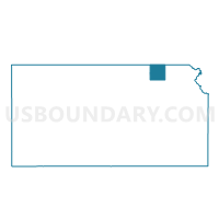
Outline

Summary
| Unique Area Identifier | 585872 |
| Name | Balderson Township Voting District |
| County | Marshall County |
| State | Kansas |
| Area (square miles) | 37.68 |
| Land Area (square miles) | 37.58 |
| Water Area (square miles) | 0.10 |
| % of Land Area | 99.73 |
| % of Water Area | 0.27 |
| Latitude of the Internal Point | 39.95453210 |
| Longtitude of the Internal Point | -96.52645290 |
Maps


Graphs
Select a template below for downloading or customizing gragh for Balderson Township Voting District, Marshall County, Kansas


Neighbors
Neighoring Voting District (by Name) Neighboring Voting District on the Map
- Barneston/Liberty Precinct, Gage County, NE
- Burchard Precinct, Pawnee County, NE
- Franklin Township Voting District, Marshall County, KS
- Guittard Township Voting District, Marshall County, KS
- Marysville Township Voting District, Marshall County, KS
- Oketo Township Voting District, Marshall County, KS
- Richland Township Voting District, Marshall County, KS
Top 10 Neighboring County Subdivision (by Population) Neighboring County Subdivision on the Map
- Precinct 5, Burchard, Pawnee County, NE (394)
- Guittard township, Marshall County, KS (373)
- Franklin township, Marshall County, KS (316)
- Liberty township, Gage County, NE (283)
- Oketo township, Marshall County, KS (234)
- Marysville township, Marshall County, KS (233)
- Barneston township, Gage County, NE (182)
- Richland township, Marshall County, KS (154)
- Balderson township, Marshall County, KS (82)
Top 10 Neighboring Unified School District (by Population) Neighboring Unified School District on the Map
- Marysville Unified School District 364, KS (5,369)
- Southern School District 1, NE (2,588)
- Axtell Unified School District 488, KS (1,649)
- Diller-Odell Public Schools, NE (1,547)
- Lewiston Consolidated Schools, NE (1,021)
Top 10 Neighboring State Legislative District Lower Chamber (by Population) Neighboring State Legislative District Lower Chamber on the Map
Top 10 Neighboring State Legislative District Upper Chamber (by Population) Neighboring State Legislative District Upper Chamber on the Map
- State Senate District 21, KS (61,803)
- State Senate District 30, NE (39,073)
- State Senate District 1, NE (33,429)
Top 10 Neighboring 111th Congressional District (by Population) Neighboring 111th Congressional District on the Map
Top 10 Neighboring Census Tract (by Population) Neighboring Census Tract on the Map
- Census Tract 9678, Pawnee County, NE (2,773)
- Census Tract 9652, Gage County, NE (2,771)
- Census Tract 901.86, Marshall County, KS (2,353)
Top 10 Neighboring 5-Digit ZIP Code Tabulation Area (by Population) Neighboring 5-Digit ZIP Code Tabulation Area on the Map
- 66508, KS (4,375)
- 68466, NE (1,861)
- 66406, KS (421)
- 66541, KS (264)
- 68381, NE (249)
- 66518, KS (189)
- 66438, KS (149)